

Sewer Networks
Array
999,00 €
Product Info
Version 23
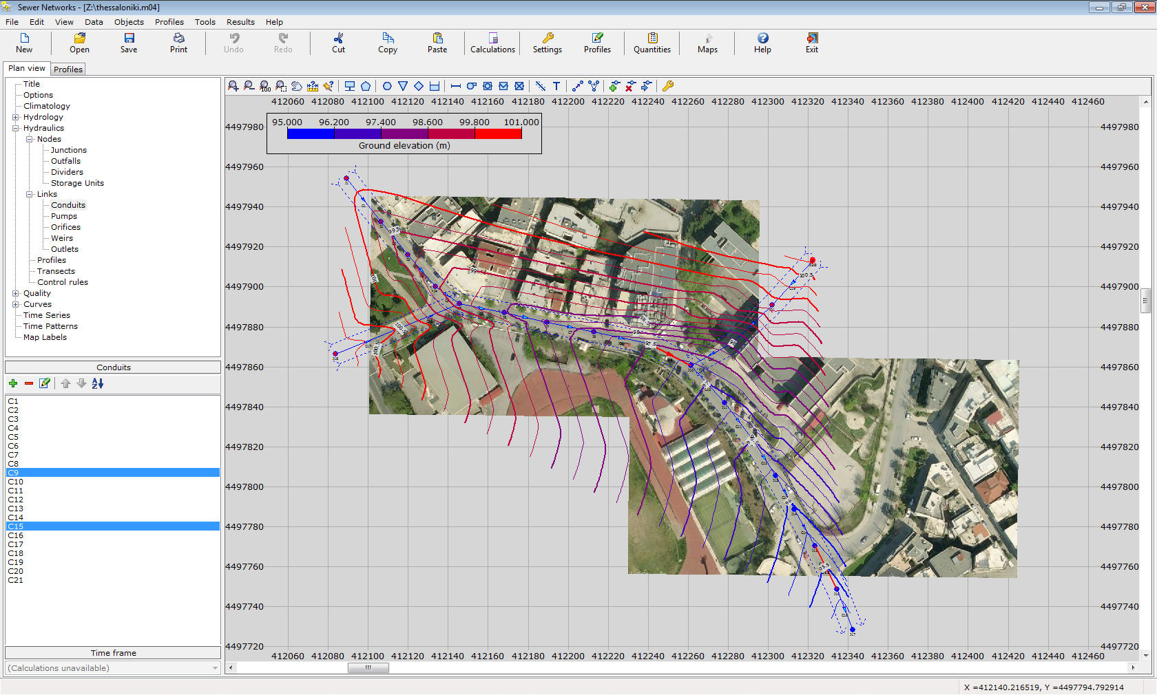
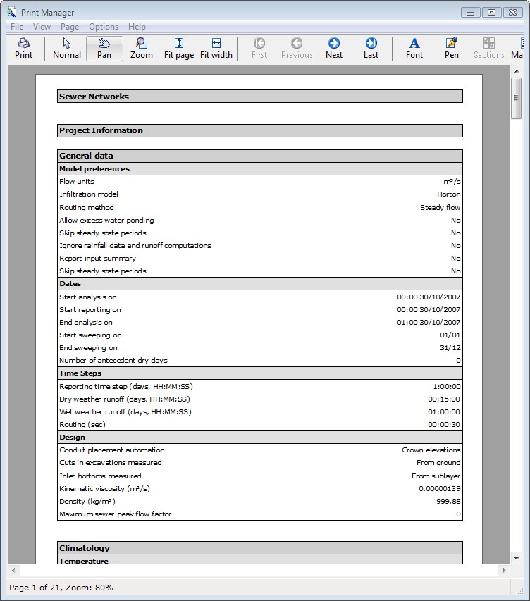
This program solves storm and sewer networks in which the flow may or may not be under pressure. Apart from hydraulic calculations, the program is able to perform optional quality checks e.g. for combined networks (sewer and storm in the same pipes). This program features a number of unique capabilities that allow for unprecedented accuracy and efficiency. Data input is performed in plan view and/or in profile view with an embedded spreadsheet. Data are auto-filled by application of logical rules. The profile is active and features CAD capabilities, while it can be exported in DXF drawings. Rainfall can be calculated based on either raingage data or IDF curves. Full flexibility is allowed in the definition of inflows. Full professional reports, including hydraulic results, quantities, excavations, etc are available with a press of a button.
Features
- Solves storm drainage networks.
- Solves sewer networks.
- Solves combined networks.
- Infinite number of nodes:
- junctions
- inlets
- dividers
- storage tanks.
- Infinite number of links:
- pipes
- pumps
- orifices
- weirs
- outlets.
- Infinite number of water catchments.
- Full hydrology:
- rainfall (from IDF curves or rain gages)
- evaporation
- snowfall
- ground water & aquifers.
- Time varying variables (i.e. flow rates)
- Inflows may be entered as:
- absolute numbers
- serviced areas
- populations
- rainfall dependent inflow / infiltration (unit hydrographs)
- dry weather inflows.
- Automated data fill where applicable.
- Calculation of node elevations using Google API (requires a free Google API key).
- Capability of creating a background collage of satellite images. The images are inserted through a special window in any resolution desired. The images are modified automatically (with translation, rotation, skewness) to fit a certain coordinate system. The overlap is precise and the boundary of the images is practically invisible. This allows the full coverage of the area of the project and diminishes the posibility of error. This capability requires an Internet connection. Also, the quality of the sattelite images varies. The images may be exported in a DXF 2000 file.
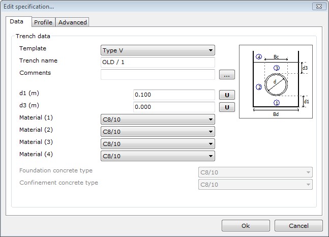
- Pipe, inlet and ditch specifications.
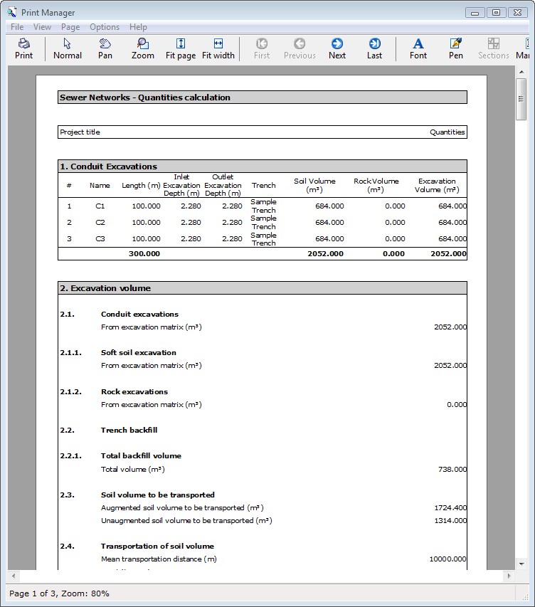
- Quantities measurement reports.
- Solve with free flow, pressurized pipes or any combination.
- Steady flow or unsteady flow solvers (kinematic wave or dynamic wave).
- Compatible with American or Hellenic specifications.
- Full quality model: pollutants, land uses, calculation of self-cleaning velocities.
- Multiple level undo and redo.
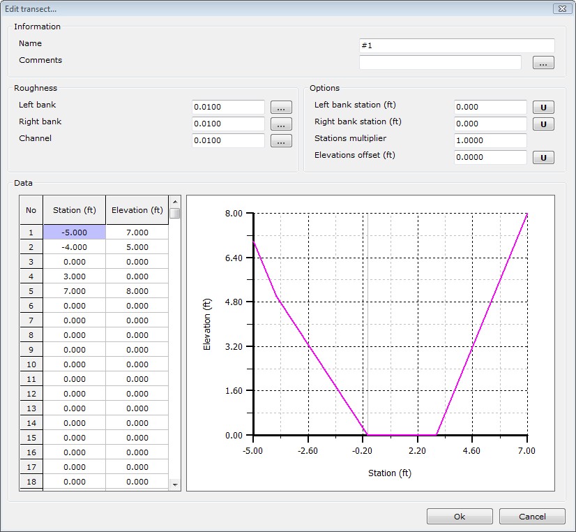
- Wide range of section geometries:
- circular
- rectangular
- triangular
- oval and wide oval
- baskethandle
- simple and normal horse-shoe
- simple and normal mouth-shaped
- arch
- ellipse (horizontal and vertical)
- parabolic
- etc.
- Transect sections are supported.
- Data input is easy and fast via spreadsheets.
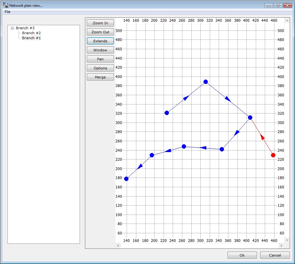
- Active profile sketch with pan, zoom, distance measure, edit etc.
- Import / export plan view from / to DXF/GIS/GPS/LandXML
- Export plan view and profiles to DXF files
- Import / export data from / to Microsoft Excel and other spreadsheets.
- Databases: friction factors, IDF curves, materials.
- Compatible with EPA SWMM and all former versions of TechnoLogismiki Sewer and Storm Networks.
- Sewer inflows can be defined based on populations or areas.
- Enhanced Microsoft Word reports (both simple and formatted).
- Significantly improved DXF output. All dimensions are based on the printing scale. The object descriptions can contain virtually any information.
- Batch renaming of the nodes in profiles.
- Capability of using different color per pipe specification in the plan view.
- OSNAP points from the objects in the background.
- Object coloring based in their properties or results. The objects can be categorized in up to 255 classes.
- Dynamic change of symbol sizes based on zoom factor.
- Evaluation of ground elevation based on satellite data.
- Tip of the day.
- Professional reports and printouts.
- A host of tools and automations.
- Full user guide
- Tutorials
- Live Update
- English and Greek interface